


![YouTube SEO in 2024 [Definitive Guide]](https://getpixie.com/wp-content/uploads/2024/02/shutterstock_1684828252-1-150x150.jpg)
Historical images play an equally important role for both scientific and industrial purposes. They demonstrate the changes that have taken place in the region over a long time and identify trends and consequences of various processes.
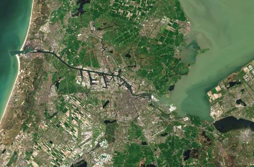
Satellite imagery from online platforms like EOS LandViewer has become an integral part of many industries. They are used to monitor climate change, the state of agricultural areas, eliminate the consequences of natural disasters, etc.
History of Satellite Images
Satellite imagery began in 1946 when an American V-2 took the first pictures during a suborbital flight. The Explorer 6 Research Center took the first orbital photos in 1959. Simultaneously, the first moon’s far side pictures were taken during the Soviet mission. In 1977, the KH-11 satellite system received the first real-time imagery. These images were of excellent research value at once, but today they are already part of history and are freely available to everyone. Private companies also started to use this technology in the following decades, including commercial purposes. And today, thanks to the unique applications’ advent, we have access to a massive database of satellite pictures.
LandViewer
It is one of the most sought-after online historical satellite imagery platforms and has been around since 1982. One of its advantages is a flexible search system that allows you to look for images by date and location. Another important nuance is the opportunity to save files for free.
The LandViewer library contains images from different periods, and you can select a specific satellite base. To better understand which collection you need, you can read information about the satellite, including when and for what purpose it was sent, the characteristics of its images. All collections are available in low and medium resolution with a range of up to 10 meters per pixel. The frequency is up to several days. Thus, everyone can analyze the changes in a specific historical period anywhere on the planet. If necessary, you can create an interactive map in LandViewer and publish it on social networks or your website. Such a source base is helpful for various purposes, such as analyzing urban growth, monitoring construction work, or tracking the state of the environment in different regions.
Historical aerial photograph collections can supplement rather old satellite images. They cover less area but have a higher resolution. For example, in LandViewer, there is a set of pictures from the National Agriculture Imagery Program (NAIP) 2010-2017 mission.
Google Earth Pro
Another way to find free historical snapshots is to use the Google Earth app. It exists in several versions: Google Earth for mobile devices and Google Earth Pro for computers. Please note that you need to install the application for using full functionality, as the browser version does not provide all the content.
First, mark the location you want on the map. You can do it yourself by rotating the virtual globe or typing the region’s name in the search bar. When the application detects the location, the View button appears; click it and select the Historical Imagery tab. After that you will see the timeline with vertical lines on the screen. These are the dates for photographs — the closer to today, the more high-resolution photos. If there are many images, you can reduce the time range and vice versa.
Esri’s Wayback Living Atlas
It is a pretty new archive; the earliest image date is 2014. However, it is so large that you will most likely find anything if you are looking for photos from recent years. Additionally, the service provides valuable information such as traffic, weather, demographics, and so on. The data is updated regularly. After selecting a location, a list of available images will appear on the left side of the screen. It is also possible to compare changes between the picked image and the rest of the listed files.
Thus, there are several online platforms and applications today where you can find historical satellite images of a wide variety of regions. Due to their availability, we can use such data in a technological environment and even at home. Most applications have desktop and mobile versions compatible with all known operating systems. You can use this data for both production and educational purposes. In any case, historical images provide us with necessary information about how the planet changes, how humans affect it, and the prospects for our future existence.