


![YouTube SEO in 2024 [Definitive Guide]](https://getpixie.com/wp-content/uploads/2024/02/shutterstock_1684828252-1-150x150.jpg)
Monitoring of Global Climate Changes with Satellite Camera
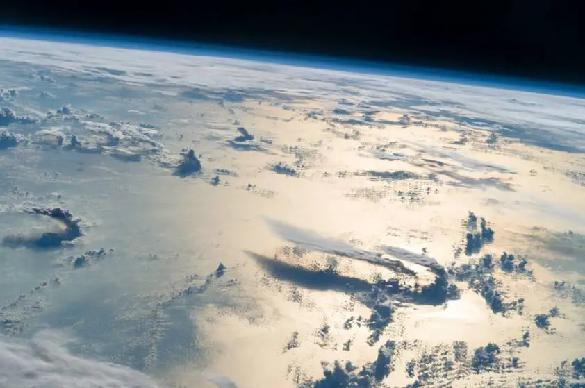
Climate changes have been a pressing concern for decades, as more governments worldwide have started introducing initiatives to combat the ever-increasing climate change danger. No doubt, the actual measures to address climate change should be taken here, on Earth, but space tech, particularly advanced satellite cameras, plays a crucial part in environmental monitoring. Find out how earth observation satellites contribute to analyzing climate changes worldwide.
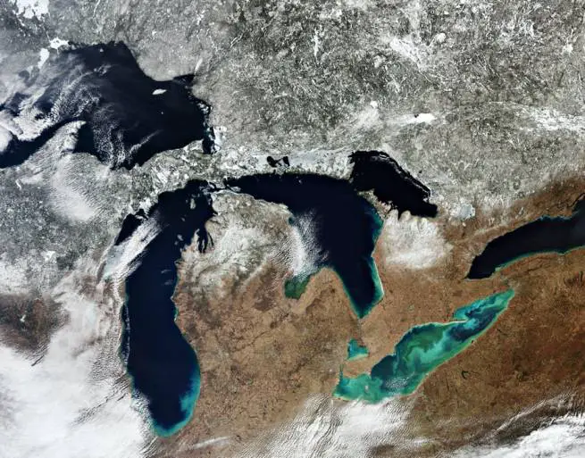
Glacier Melting & Sea Level Rising
Sea level rising is one of the most obvious consequences of climate change, caused primarily by glaciers melting. While the pattern of sea levels changing is not the same across different oceans, satellite cameras have already shown that this level rises about 3.2mm each year. This may not seem like a very alarming figure, but a simple calculation shows that by the end of the century, this climate change trend could lead to a 2m increase in sea levels. As a result, roughly 600 million could be flooded — particularly in the Pacific area.
Glacier and permafrost melting may be the major factor contributing to rising sea levels, but ice thawing has another pressing climate change consequence. As the ice melts, it emits CO2 into the atmosphere, which leads us to the next point.
Monitoring CO2 and NO2 Pollution Levels
The more CO2 is emitted into our planet’s atmosphere, the more heat it traps, leading to a chain global warming reaction and further increasing the rapid claimed change. The main problem with CO2 and other greenhouse gases accumulating in the atmosphere is that their molecular structure does not allow the reflected warmth to penetrate carbon dioxide levels. Unlike methane, another greenhouse gas that absorbs even more heat but stays in the atmosphere for no longer than a decade, CO2 can persist for anywhere between 300 and 1000 years, changing our climate quite drastically.
Nitrogen dioxide (NO2) is another pressing climate change concern — not only when it comes to heat absorption but also because of its harmful effect on human health. This gas is mostly emitted by combustion engines in cars and other vehicles, and the recent COVID-19 shutdown has vividly shown a rapid decrease in NO2 pollution — sadly, not for long.
Today’s capability of satellite imagery allows keeping track of all these climate changes. ESA’s Copernicus Sentinel-5P, launched in back 2017, does, even more, keeping watch on ozone and aerosol levels. Besides, ESA is not alone in observing carbon pollution levels as NASA, and JAXA (Japanese Space Agency) also monitor carbon and methane emissions in 55,000 locations worldwide, contributing valuable data on climate change.
Tracking Deforestation & Desertification Levels
Increased deforestation is another cause of major CO2 emissions into our atmosphere. Roughly a quarter of all harmful emissions into our atmosphere happen because forests, natural sources for capturing carbon, are dwindling. The level of deforestation is quite obvious in Brazil and Indonesia — and all of these alarming insights have been made possible thanks to the best satellite camera technology and climate change monitoring.
However, it’s not only the forest cover that is dwindling. As a result of increasing climate change, acres of formerly fertile land are now gradually turning into a barren desert. Unless countermeasures are taken, commercial agriculture as we know it may be put at risk, and the consequences of disrupting the food supply can be truly devastating. This alone pretty much answer the question of why to use satellite camera — eventually, analyzing climate change data may help scientists come up with viable solutions to the problem.
Analyzing Ocean Pollution & Coral Reef Dwindling
Besides monitoring pollution levels in the atmosphere, climate change satellites are keeping watch of ocean pollution. But how does a satellite camera work when it comes to observing deep waters? The logic behind taking sea images is not that different from taking pictures of land — climate monitoring satellites use infrared and optical sensors to track any color changes at sea and rely on transmitters to send this information back to the ground stations. Changes in color can also indicate changes in sea temperatures — and climate change satellites observe and document these data.
Recent satellite imagery shows tons of plastic dumped into the ocean each year, which endangers marine life, leading to species extinction, disruption of the food chain, and, consequently, further aggravating of the already alarming climate change issue. Today, the marine ecosystem is most endangered in the areas naturally covered by coral reefs. While corals may occupy a relatively small part of the ocean, they still host around a quarter of all marine species local to this region — species used to feed people in developing countries. Recent stats show that half of the world’s corals have already been destroyed in the last 30 years alone.
So, what is the satellite camera role in addressing climate change? Right now satellite imagery obtained from space is mostly used to collect and analyze data on climate change. Eventually, however, it will be used to come up with valid solutions for combating climate change — and, hopefully, this day should come sooner than later.